blue plaque · Wales

Boundary Wall, Newport

Photograph at the Boundary Wall, Newport blue plaque

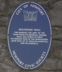
Boundary Wall. This marked the limit of the town from its medieval origins until 1835, when its first extension took in the workhouse (now part of St Woolos Hospital) and Pillgwenlly

Inscription drawn from imported open data, awaiting original TributeLegacy editorial.

Source: Open Plaques. Geographic data via OpenStreetMap.

Nearby locations in Wales

Browse all memorials in Wales

Data sources

Location records are drawn from open, licence-clean datasets, kept here with attribution and gratitude to the people who maintain them.

  • Open Plaques, dedicated to the public domain (CC0). See openplaques.org.
  • Wikidata, available under the CC0 1.0 Universal dedication.
  • © OpenStreetMap contributors, available under the Open Database Licence.
  • Historic England, National Heritage List for England, used under the Open Government Licence v3.0. War memorial records are drawn from open community datasets (OpenStreetMap, Wikidata, NHLE) — never from the Commonwealth War Graves Commission, which is excluded.

Editorial descriptions, photography and tribute links are original TributeLegacy work, layered on top of the open data.

Directions to here