black plaque · Scotland

Black plaque № 43931

Photograph at the Black plaque № 43931 black plaque

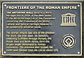
Frontiers of the Roman Empire. The Antonine Wall became a World Heritage Site in 2008. It has been added to the World Heritage List of the Convention concerning the Protection of the World Cultural and Natural Heritage because of its outstanding universal value. The Roman empire was one of the greatest the world has ever seen. Its frontiers, extending 5,000km through Europe, the Middle East and North Africa, form the largest single monument to Roman civilisation. The Antonine Wall formed the north-west frontier from AD 142 to about 165.

Inscription drawn from imported open data, awaiting original TributeLegacy editorial.

Source: Open Plaques. Geographic data via OpenStreetMap.

Nearby locations in Scotland

Browse all memorials in Scotland

Data sources

Location records are drawn from open, licence-clean datasets, kept here with attribution and gratitude to the people who maintain them.

  • Open Plaques, dedicated to the public domain (CC0). See openplaques.org.
  • Wikidata, available under the CC0 1.0 Universal dedication.
  • © OpenStreetMap contributors, available under the Open Database Licence.
  • Historic England, National Heritage List for England, used under the Open Government Licence v3.0. War memorial records are drawn from open community datasets (OpenStreetMap, Wikidata, NHLE) — never from the Commonwealth War Graves Commission, which is excluded.

Editorial descriptions, photography and tribute links are original TributeLegacy work, layered on top of the open data.

Directions to here