
blue plaque · Northern Ireland

Ballymoney United Irishman 1
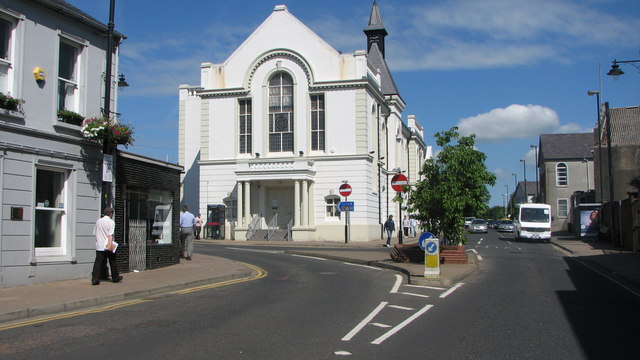
Photograph at the Ballymoney United Irishman 1 blue plaque

Ballymoney (Irish: Baile Monaidh [ˌbˠalʲə ˈmˠɔnˠə], meaning 'townland of the moor') is a town and civil parish in County Antrim, Northern Ireland. It is within the Causeway Coast and Glens Borough Council area. The civil parish of Ballymoney is situated in the historic baronies of Dunluce Upper and Kilconway in County Antrim, as well as the barony of North East Liberties of Coleraine in County Londonderry. It had a population of 11,048 people at the 2021 census. The town was established by Scottish settlers following the Tudor Conquest of Ulster at the beginning of the 17th. century. In the 18th. century, the townspeople supported the dissident Volunteer and United Irish movements. In the 19th. century, they supported tenant farmers in their agitation for tenant right and land ownership.

Source: Open Plaques. Geographic data via OpenStreetMap.

Nearby locations in Northern Ireland

Browse all memorials in Northern Ireland

Data sources

Location records are drawn from open, licence-clean datasets, kept here with attribution and gratitude to the people who maintain them.

  • Open Plaques, dedicated to the public domain (CC0). See openplaques.org.
  • Wikidata, available under the CC0 1.0 Universal dedication.
  • © OpenStreetMap contributors, available under the Open Database Licence.
  • Historic England, National Heritage List for England, used under the Open Government Licence v3.0. War memorial records are drawn from open community datasets (OpenStreetMap, Wikidata, NHLE) - never from the Commonwealth War Graves Commission, which is excluded.

Editorial descriptions, photography and tribute links are original TributeLegacy work, layered on top of the open data.

Directions to here