bronze plaque · England

Ordnance Survey

Photograph at the Ordnance Survey bronze plaque

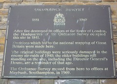
Ordnance Survey 1841 - 1969 After fire destroyed its offices at the Tower of London, the Headquarters of the Ordnance Survey occupied this site in 1841. Decisions which led to the national mapping of Great Britain were made here. The original buildings were seriously damaged in the enemy air-raids of 1940; the older buildings still standing on the site, including the Director General's House, are a reminder of that age. The Ordnance Survey moved from here to offices at Maybush, Southampton, in 1969.

Inscription drawn from imported open data, awaiting original TributeLegacy editorial.

Source: Open Plaques. Geographic data via OpenStreetMap.

Nearby locations in England

Browse all memorials in England

Data sources

Location records are drawn from open, licence-clean datasets, kept here with attribution and gratitude to the people who maintain them.

  • Open Plaques, dedicated to the public domain (CC0). See openplaques.org.
  • Wikidata, available under the CC0 1.0 Universal dedication.
  • © OpenStreetMap contributors, available under the Open Database Licence.
  • Historic England, National Heritage List for England, used under the Open Government Licence v3.0. War memorial records are drawn from open community datasets (OpenStreetMap, Wikidata, NHLE) — never from the Commonwealth War Graves Commission, which is excluded.

Editorial descriptions, photography and tribute links are original TributeLegacy work, layered on top of the open data.

Directions to here